To view any full size image and caption details please click the maroon button below each thumbnail
 Abergavenny To Merthyr
This page provides information and photographs relating to the closed railway line running between Abergavenny and Merthyr Tydfil.
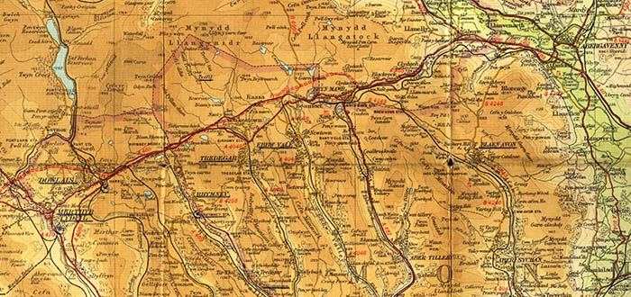
The map below shows the railway running due West from Abergavenny to Merthyr Tydfil, climbing for much of the journey over some of the steepest railway gradients in the UK .
The area through which the railway ran was a hive of activity during the industrial revolution, being served by numerous tramroads, canals and plateways, connecting the many industrial sites. The original route of many of these tramroads provided the foundation for the Merthyr, Tredegar and Abergavenny railway which obtained its act of parliament on the 1st August 1859. After some inter railway company rivalry the route was eventially leased by the LNWR by a further act of parliament on the 7th August 1862.
The route opened in sections, firstly from Abergavenny to Brynmawar on the 29th September 1862, Brynmawr to Nantybwch on the 1st March 1864, Nantybwch to Rhymney on the 5th September 1871 and from Rhymney Bridge to Dowlais on the 1st January 1873. Westestwards from Dowlais access to Merthyr was achieved by the LNWR establishing joint running powers over part of the Brecon and Merthyr lines via Morlais junction.
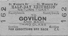
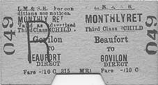
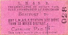
Throughout the route various connections were made with the other railway lines that served the area including The Brecon and Merthyr, Rhymney and the GWR. The connections made proved useful for the transportation of both goods and passenger throughout the operational life of the line.
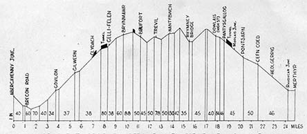
The line was notorious for its steep gradients, tortuous curves, high viaducts and lengthy tunnels making it a spectacular journey to travel on. From Brecon Road station the line climbed continuously over gradients as steep as 1 in 34 for nearly 9 miles, to a summit close to Beaufort reaching approximately 1,200 feet above sea level. The gradient profile shown below illustrates the severe gradients encountered, that were no doubt a serious challenge for the locomotive crews operating the services.
With its proximity and connections to the Welsh coal mining area the line carried vast quantities of coal and was recognised as one of the routes used for the Jellicoe coal trains supplying the British naval fleet at Scapa flow during WW1.
At various times throughout its existence the line had several branch connections including Brynmawr to Blaenavon, Brynmawr to Nantyglo, Beaufort to Ebbw Vale, Nantybwch to Tredegar and Rhymney Bridge to Rhymney. Passenger services over these lines gradually disappeared with Brynmawr to Blaenavon being withdrawn on 5th May 1941, Rhymney Bridge to Rhymney being withdrawn on 21st September 1953 and Beaufort to Ebbw Vale being withdrawn from 2nd April 1951.
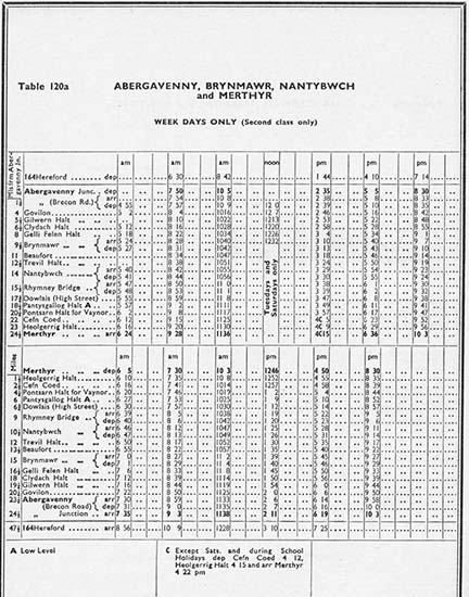
An extract from the British Railways timetable valid from 17th September 1956 to the 16th June 1957 is shown below, indicating the available train services at the time.
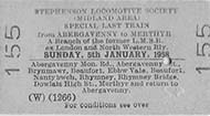
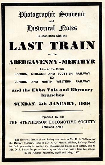
Closure of the line to passenger services came on on the 6th January 1958, with through goods services being withdrawn as early as 22nd November 1954. The closure of the line was marked by a Stephenson Locomotive Society special train traversing the length of the line for the last time on the 5th of January 1958. This was to be rather a fitting tribute to the line using two ex-LNWR locomotives in the shape of Webb coal tank 0-6-2T locomotive number 58926 and Bowen-Cooke G2a 0-8-0 locomotive number 49121.
A gallery of photograhs taken at the various locations along the line appears below and follows a journey from Abergavenny to Merthyr as well as some of the connecting branches.
Section links
