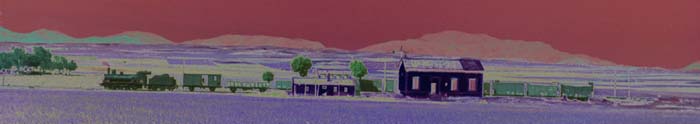
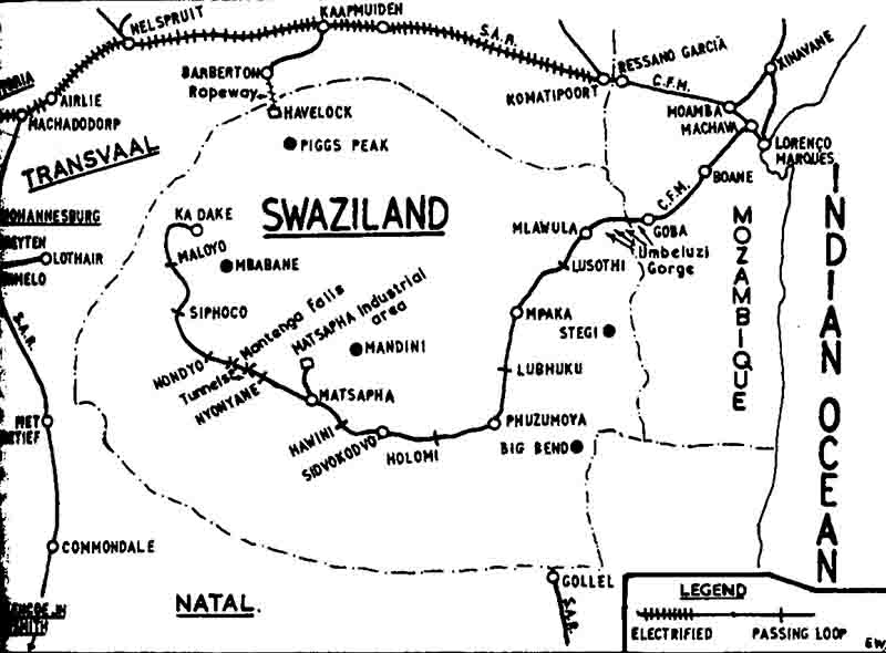
The construction of CFM line from Lourenço Marques to Goba opened in 1905 was planned to extend into Swaziland but this failed to happen. It was not until the development of Ngwenya ironstone mine at Ka Dake in the early 1960s finally gave the impetus to the extention from Goba right across the country to the mine close to the western border with South Africa. This opened in 1964 with motive power supplied by the CFM, so enabling the export of higb grade hematite iron ore through the port at Lourenço Marques. However by 1977 declining demand resulted in the cessation of mining operations not helped by transport difficulties caused by the wars in Mozambique. The unreliable service from CFM left large heaps of mined ore at Ka Dake which resulted in rail traffic continuing until 1980, after which the line west of Matsapha was closed and lifted. In 1977 South African Railways agreed to construct a line from Golela, then the terminus of the Natal North Coast line, to connect with existing line at Phuzumoya east of Sidvodkovo. This opened in 1978 and allowed the heaps of previously mined ore remaining at Ka Dake to be exported this way with traffic powered by SAR class 14R 4-8-2s. In 1986 a northern link from Komatipoort to Mpaka was opened by SAR so providing a more direct route from the then eastern Transvaal to Richards Bay and Durban.
To view any full size image and caption details please click the maroon button below each thumbnail