To view any full size image and caption details please click the maroon button below each thumbnail
 Bengal Railways
This gallery mainly covers the Eastern Bengal Railway but as there are only 4 pictures relating to the Assam - Bengal Railway, this is also included here. The pair were in any case merged to form the Bengal & Assam Railway in 1942.

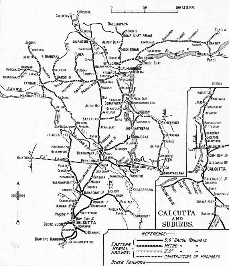
A map of Eastern Bengal system of 1763 route miles as it existed in 1929. This includes both broad, metre and 2ft 6in gauge sections.

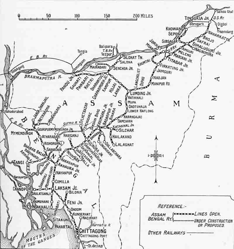
A map of Assam-Bengal system of 1152 route miles as it existed in 1929. This was all metre gauge.
The Eastern Bengal Railway Company was established by an act of parliament in 1857 to
construct railways to the east of Hooghly River. It was taken over by state in 1884.
Initially the broad gauge lines were restricted to the area south of the Ganges (Padma)
but completion of the Hardinge bridge in 1912 led to the extension of this to Silguri.
At the time of this map the metre gauge lines serving Dacca remained isolated, only
connected by ferry across the Brahmaputra/Padma rivers.
The Assam Bengal Railway Co. Ltd. was formed in 1892 to provide access to the port of
Chittagong from the tea plantations in Assam. The first section opened to traffic in
1895 and Tinsukia was reached in 1902. The company remained independent until taken
over by the state in 1942.
Section links
